Viewings: 3669
In the beginning of 2011 in the US and Europe lashed by severe frosts, although in Greenland and Alaska was unusually warm. This year, in late winter in the US and Europe, in contrast, was hot, yet the air is cold hung over Central Europe and Asia. In the Northern hemisphere extreme weather conditions in winter are usually associated with a negative phase of the Arctic oscillation - the rose of winds, which are dominant in the polar region. And scientists come to the conclusion that changes in the Arctic, may have led to long stay oscillations in a negative mode.
Charles Greene, of Cornell University (US) notes that now the character winters in the Northern hemisphere will change for a long time.
When the Arctic oscillation is a positive phase, strong winds known as the polar vortex. Because of him Arctic air masses are blocked in the area of the pole and does not reach the middle latitudes. Besides, due to this phenomenon the jet stream atmosphere become more direct, and winter is issued more moderate.
But in recent years oscillation was sharply negative phase, and in 2010 were registered record low temperatures in many regions. The fact that the winds of the polar vortex lessened, and the cold Arctic air is mixed with the air masses of the middle latitudes. In the jet stream become weaker and also start deviating to the North and the South. This leads to the severe cold weather in the US and Europe, but at the same time meandering jet stream is able to bring to the North warmer southern air, which occurred in the U.S. this spring.
Some scientists have suggested that prolonged negative phase may be due to loss of sea ice in the Arctic. A couple of years this idea came from an embryonic state, granted a serious research.
A mechanism similar to the following.
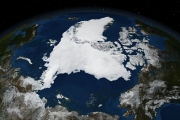
The area of sea ice is decreasing since then, as with the Arctic was set satellite surveillance. It seemed, that all used to, but in 2007 there was a sudden and very sharp decline, from which the ice is not recovered yet. During all subsequent years (with one exception, the downward trend was stronger than in previous years (see graph below).
This situation has a significant impact on local conditions. During the summer the open ocean absorbs much more sunlight than before. In autumn it returns the part of the heat produced in the atmosphere, warming the air over the Arctic. This is to some extent erases the differences between the Arctic region and the more temperate latitudes, resulting in the likelihood of the formation of the polar vortex is reduced. In short, the lack of ice enters the Arctic oscillation in the negative phase and increases the chances cold winter in the Northern hemisphere. This, in turn, makes weakened and became a meandering jet currents of the atmosphere to stay longer in the same position.
Meandering jet currents increases the likelihood that warm southern masses could escape to the North. In March, the heat in the U.S. was due to this phenomenon, which coincided with La Nina in the Pacific: the warm air was brought to the North, where he was forced to be an unusually long time.
The study is published in the journal of Oceanography.
Prepared according to Ars Technica.