
|
Viewings: 11927
 It provides information about the temperature and salinity of the Bermuda triangle, their dynamics, especially on the currents, which, as many people believe, is the mysterious power, which is a cause of unexplained accidents and disappearances. It provides information about the temperature and salinity of the Bermuda triangle, their dynamics, especially on the currents, which, as many people believe, is the mysterious power, which is a cause of unexplained accidents and disappearances.Lower (southern) part of the triangle refers to the tropical seas, large (North) - subtropical. Tropical sea, as it is known, is warmer and more saline. Our triangle in this sense is not an exception. The water temperature on the surface varies here from 22 to 26 C, but in shallow waters of the Bahamas cans, and in the bays and lagoons may be much higher. The salinity of water is only slightly higher than the average, that is equal to about 36-37 ppm (36-37 g of salt per 1 kg of water). With the exception again, is the shallow waters of the Bahamas cans, bays and lagoons, where the salinity may increase to 41 ppm, and in some isolated parts even to 46 ppm. In more Northern, subtropical parts of the triangle fluctuations in temperature greater. Summer temperatures range between 30 and 35 degrees C. in winter is between 15 and 25 degrees C. the Water is much warmer than in other parts of the ocean on the same latitudes. And "guilty" in the already mentioned the Gulf stream carries warm water far to the North (about it below). The salinity of water more (North) side of the triangle is equal to the average oceanic value (35 ppm). In the East the Bermuda triangle captures a small part of the Sargasso sea, the salinity of water which is above average (36,5 ppm). Even more interesting are ocean currents. We can with certainty say that it is within the Bermuda triangle is the core of the circulation of water masses of the Atlantic ocean. Harmless to repeat how, in fact, occur ocean currents: a) the main cause of the oceanic system currents are wind system. The activity of constant winds causing currents forced-called drift, that is induced by the wind; b) forced flows can continue their movement outside the wind by inertia as current inertial; in) the water is carried out with a specific place, should be compensated by inflow of water from another place, and, on the contrary, water, fitting in a specific area, must in some way no. Appearing currents are called surge, or compensation. A special type of compensation currents are current gravitational arising under the influence of gravity or under the influence of slope of the sea surface. This tilt may occur because of the excess water in a certain area; d) of course also arise between individual oceanic water masses with different temperatures and salinity. Such trends are called convection. Currents form in the World ocean closed circuits. Every particle of water after years of different ways, falls again back to where it started. The main trend in the Bermuda triangle is the system of the Gulf stream. The term "system"because it is not about any one, strictly isolated within, and indeed of the whole system. Its total length from the coast of Florida to the New Earth is 10,000 km From the Gulf of Mexico this water flow comes as the Florida current, then off the coast of North America down to Cape Hatteras and even to Newfoundland called the Gulf stream, and from there to the very shores of Europe carries its waters of the North Atlantic current. Be used for all parts of this system name "Gulf stream" is possible only for the sake of simplicity. The name of the Gulf stream obliged the Gulf of Mexico (English Gulf - Gulf shores, previously Golf of Mexico), so it has long been thought that the Gulf stream is born in this Bay. I also believe that the bulk of the waters of the Gulf stream also comes from the Gulf of Mexico, the level of which is enhanced because of the inflow of waters of the Mississippi. This excess water has to go somewhere, so thought he follows in the Florida Strait as the first link of the system of the Gulf stream. But this theory lasted only until 1970. It turned out that in reality the situation is much more complicated. He calculated the exact balance of consumption of water and found that the contribution of the Gulf of Mexico is only one-tenth of flow of the Gulf stream. The main part of water, which is the Gulf stream comes directly from the Atlantic ocean, to the East, where they bring the Northern and southern Trade-wind currents. South Trade over the Brazilian ledge South America is divided into two branches. North crosses the equator and is connected to the North by the Trade flow. The merger of these two currents occurs Guiana current that moves along the northeastern coast of Brazil to the Antilles. Part of its water penetrates through the Straits between Islands in the Caribbean as the Caribbean current. The second branch turns along the outside of the lesser Antilles to the North as the Antilles current. Both these branches, the Caribbean and the Antilles, deliver to the Gulf stream, the main mass of water. Carried by the Gulf stream, this water goes to Europe, partly in the form of Portuguese and Canary currents again getting in Northern Trade-wind flow. And this endless cycle. It should also be added that part of the waters brought to the American continent, in the Gulf stream misses, and immediately returns back as Megasite counterflow, reaching approximately along the equator between both Western currents, North Trade and Southern Trade. Direct influence of the Gulf stream we can feel good half of the water area of the Bermuda triangle, indirect - on the rest of the country and even beyond. The table shows some characteristics of the Gulf stream and other neighbouring Atlantic currents. System characteristics of the Gulf stream (The Florida current, actually the Gulf stream and North Atlantic current) and other currents of the Atlantic ocean For water Consumption, m2 Width, km Speed, cm/s Florida 50-80 15-20 100-250 Golfstrim 80 to 200 80-140 The serero-Atlantic 15 200-300 50 North and South Trade 1-30 300-1000 20 Megasteno counterflow 1-60 300-500 30 The Gulf stream carries about 100 million tons of warm water per second. It is in tens times more than maximum flow largest and most full-flowing rivers in the world (the Amazon and Mississippi). The width of the Florida flow in the place where it leaves the Gulf of Mexico, is 15-18 km further North, where it already dominates the Gulf stream, the width of the current reaches 200 km His amazing speed, 100-250 cm/s, sometimes even more. If this figure is translated into km/h, you get from 3.6 to 9 km/h and, according to some data, the speed of the Gulf stream may exceed 10 km/H. the speed of the flow is really great. It can be compared, perhaps, with the speed of the Danube in Bratislava, and in conditions of turbulent flood. To finally have respect for the power of this thread, remember that the average speed of many transoceanic ships only 2 times more 15-30 km/H. Thus, the Gulf stream can significantly slow down or speed up the movement of the ship, whichever floats against it or downstream. The Gulf stream refers to the warm currents. The Labrador current, rushing to meet him from the North and passing near the mainland, on the contrary, cold. This division into warm and cold currents relatively warm are those currents that bring warm water in the higher latitude, cold, on the contrary, bring cold water in polar latitudes lower, closer to the equator. In tropical waters around Florida temperature differences to see even impossible. However, slightly to the North in Bermuda, these differences are already being felt. The waters of the Gulf stream can be 10 C warmer than the surrounding ocean waters. It is very difficult to believe that the temperature may rise or fall by 10° at a distance of several tens of meters, depending on, we come into the borders of the Gulf stream or leave it. So sharply defined its boundaries! To summarize now, as the Gulf stream influence the water of the Bermuda triangle, and what could be its role in the dubious reputation, which has this part of the ocean: a) for fast, make it difficult or completely inhibits the movement of ships, floating against him; b) current pulse, changing its speed and location sometimes systematically, sometimes haphazard, and these changes is absolutely impossible to predict. It can bring unexpected surprises even those vessels that are not in the current, and nearby; C) during creates irregular vortices and deviations. Some vortices exist for many days and have considerable power. Low-powered vessels substantial efforts are needed to break out of such turbulence; g) for the effect on the weather. At the edge of his warm water to cooler surrounding water frequent fogs. All these circumstances should be taken into account when analyzing the mysterious phenomena of the Bermuda triangle. Reading about misty walls or "destructive vortices", we should immediately to remember our old friend - the Gulf stream. In Bermuda treugolnick exist and small currents, called local, or local. Very strong and irregular flow arise under the influence of the tides. And although the water level fluctuations in the Bermuda triangle not belong to the highest (in Nassau, Bahamas 78 cm, about Florida and on the Northern coast of Cuba 15-70 cm), however during the tides they cause in the narrow Straits of the stream, rushing at speeds of over 100 cm/S. at various points In the Bahamas cans tidal and tidal currents can lead to the formation of vortices. In many places cans have even channels, "dug" otlicnyi flows. Their depth is 10 m or more, while the surrounding surface of the cans is located almost at sea level. The most powerful flows are brought Gale-force winds. As Florida and the Bahamas, to be more precise, all the Bermuda triangle is an area of hurricanes. When wind speeds in excess of 120 km/h, and gusts of 300 km/h, in the Straits, as well as through the Bahamas banks and other shallow water and channels rushing water shafts with a speed of 10 m/S. They are split on the coral reefs, and the ship, who were among them, were doomed to death. The Sargasso sea From the East within the Bermuda triangle "invades" very interesting, full of legends Sargasso sea. Let's start with its location. On the West and North it is limited by the Gulf stream, East of 40 degrees C. D. in the South 20 degrees North latitude. However, this is not a geographical concept, like, say, Gulf of Mexico, or the North sea, so geographers and not insist on very precise definition of its borders. If the Gulf stream will shift to several tens of kilometers, will shift and the boundaries of the Sargasso sea. What was his name? Sargaco in Portuguese means "the grapes". It is the so-called floating in the water algae - Sargassum. They have the leaves and berries, so quite a bit of imagination, you can easily imagine that this is a bunch of grapes. In the Sargasso sea is a huge accumulation of these algae. Estimated hydrobiologists, their total weight is from 4 million to 11 million tons Beams algae swim freely in the water, somewhere more, somewhere less. It is known that their appearance has forced Columbus to assume, that to the nearby land. Unfortunately, he was wrong. Completely wrong and the idea, as if the algae on the surface of the Sargasso sea gusty as duckweed pond, and could hinder the movement of the ship. Surface of the Sargasso sea is rather like the surface of a pond in the autumn, when on it here and there you can see the floating sheet or broken branch. The Sargasso sea is in a sense an oasis of still water, surrounded by powerful currents of the North Atlantic. So all that into it enters, has been delayed in it for long. It is not only the algae, but all kinds of debris falling into the sea from the land and from passing ships. There really can sometimes be seen wooden fragments of old ships, but absolutely false assertion that there lost in a huge pile of skeletons of all the wrecks in the Atlantic over the past two or three centuries. The Sargasso sea level by 1-2 m above the adjacent to the East and South regions of the ocean. This is because in the Sargasso sea on all sides naganawa ocean water. Its own water otmechayut, but not on the surface and at depth. Consequently, circulation of waters in the Sargasso sea is as follows: on all sides to the surface naganawa water, then it is sinking into the deep, and the outflow into the surrounding ocean. The Sargasso sea is not coming out of the cold currents. From here two important implications: a) waters Sargasso sea is warmer than its surrounding waters. Moreover, these warm waters penetrate deeper, deeper than it usually happens in the ocean. At a depth of 800-1000 m, the water temperature of 10 C, while in other areas of the ocean at the same depth, the temperature is just 5 C; b) waters Sargasso sea have very low productivity. That this sea is concentrated huge mass of algae, still no evidence to substantiate the biological richness of its waters. There are few nutrients, so it is up and abundant plankton. Dark blue waters of the sea are typical oceanic desert. It has been estimated that the waters of Sargasso sea have a vast reserve of potential energy. Imagine, if subsided etesian winds, ceased to operate all the forces driving the Gulf stream. In this case, the cycle of water flows around the Sargasso sea was continued by momentum for more than 1700 days only because of potential energy, accumulated by the waters of the sea. It is hard to imagine that many legends and superstitions that have been created about the Sargasso sea. "Sea of spirits", "sea of debris", "the sea that you cannot swim", "sea Ghost... What names did not deserve this sea, being, of course, a very interesting and original, but which is nevertheless a regular part of the Atlantic ocean. However, is it any wonder the inventions of science fiction? Suits them of all that is at least to some degree can make you believe in the mystery of the Bermuda triangle. Maybe they'll find something supernatural and in the atmosphere above it?
You are reading news Воды бермудского треугольника
if You liked the article Воды бермудского треугольника,
prokomentiruet her.
|

The world of the unknown - Onua.org
Onua.org - this site created to familiarize the user with the world of the unknown, news of technology, space discoveries and mysteries of the Earth UFO, Video , Photo, the Witnesses, the mysteries of history and ancient civilizations.


Menu
- Anomalies
- Hypothesis
- The Mysteries Of History
- Unknown
- News
- Opening
- Top secret
- Prophets
- Ancient civilizations
- Egypt
- Rome
- Greece
- Anunaki
- Nazca
- Maya
- Cosmos
- Technology
- Flora and Fauna
- Atlantis
- Bermuda triangle
- Aliens and UFOs
- Cloning
- Loch Ness
- Mysticism and Magic
- Time machine
- Parallel world
- The Tunguska meteorite
- Third Reich
- Teleportation
- Snow man
- 2012
- Nibiru
- Solar system
- The sun
- Earth
- Mars
- The rest of the planet
- Photo
- Video
- A little about everything
- Украинские аномалии
- 2013-2014 YEAR
- Questions and answers
- 100 great
Interesting
Recent VIDEOS
News calendar
Join
Popular Onua.org
Photo
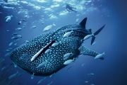
The biggest fish in the world - not blue whale as one might think, because the whale belongs to a ma
Before it was invented fridge, its functions were performed in the ice, which was considered a preci


Предлагаем восстановить, заказать, купить диплом Вуза в любом городе России. Только настоящий бланк ГОЗНАК с гарантией.
All rights reserved