|
Viewings: 11299
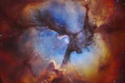
 The bottom topography in this region of the ocean well-known. We know even that is here under the seabed at a depth of several kilometers. On the Florida shelf, Bahamas and Bermuda have held a number of drilling and geophysical research. Currents, water temperature, salinity and the movement of air over the ocean are the phenomena and processes that are already thousands of pages. The bottom topography in this region of the ocean well-known. We know even that is here under the seabed at a depth of several kilometers. On the Florida shelf, Bahamas and Bermuda have held a number of drilling and geophysical research. Currents, water temperature, salinity and the movement of air over the ocean are the phenomena and processes that are already thousands of pages. And in this respect the Bermuda triangle is one of the most studied parts of the World ocean. Indeed, in the area of the Bermuda triangle was sent lots of expeditions, but not at the same time, however, as they try to convince us fans mysterious to lift the veil over his secrets, and for the study of the Gulf stream influence the ocean waters on weather conditions, to study the seabed and its mineral resources and geological structure of the crust deep under the ocean floor. Supporters of the mysterious triangle to the right in one thing: this is a very difficult area of the ocean. In it side by side vast shallow and deep trenches, a complex system of ocean currents and intricate atmospheric circulation. And we still make sure. Let's start with a description of the seabed, then go to the sea surface and complete the atmosphere. In the Bermuda triangle, we find the following forms of the seabed: shelf with the shallow banks, continental slope, regional and middle plateau, deep Straits, abyssal plains, deep grooves. A rare variety for such a relatively small area of the World ocean! We can with a certain degree of proximity to specify which part of the bottom is occupied by a separate forms of relief: abyssal plains 35% the shelf with the shallow banks of 25% continental slope and the foot of 18% regional and middle plateau 15% deep grooves 5% deep Straits 2% seamounts 0,3% The share of each of these forms was established by planimetria.htm large-scale morphological map of the seabed. Just look at the morphological the map to see that the Bermuda triangle can be divided into two parts: South with shelf of Florida, the Bahamas banks, Straits and deep sea trench Puerto Rico. In this part of the sea bottom looks rather high: the extensive shallows alternate with Straits and great ocean depths; North with more diversified topography. A wide shelf spacious deep sea of the plain, in the North and East which are seamounts and a fairly large Bermuda plateau. In the Bermuda triangle, both in the Eastern and Northern parts of it, is located a few seamounts. Some of them have names, and other unnamed. Seamounts are cones more or less correct form. They rise above the plane of the seabed at least 150-200 m and above. Lower cones are called underwater hills. In terms they have round or elliptical form, their diameter is from a few kilometers to several tens of kilometers. The slopes of seamounts steeper than the mountain slopes of the land, their bias often 10-30 degrees. No exception and forty-degree slopes. The slopes of seamounts correct, even, sometimes complicated by several of the terrace steps. In the first case, the mountain looks like a simple cones, in the second, like a huge base, from which rise some of the cones smaller. The foot of large seamounts very smoothly into the bed of the ocean. Some seamounts hide their peaks in deep water, other protrude above the surface in the form of Islands. However, in this case, the definition of "seamount" entirely appropriate, for that which rises above the ocean, represents only a small part of what is hidden under water. The island, which gave the name to the whole Bermuda triangle, are peaks of underwater mountains that rise from the surface of the Bermuda plateau. Material seamounts, basalt, hidden from our view, as the mountain is covered with powerful coral reefs. Some seamounts rise to the bottom of the ocean alone, others form the group. It should also be noted that in the Atlantic ocean them considerably less than in the Pacific, where their number is about 2000 (in the Atlantic ocean, there are only a few dozen). In the Bermuda triangle, in its traditional boundaries, there are no more 5-b seamounts. Seamounts - the phenomenon is certainly very interesting, but in our time is not mysterious. They were formed as basalt mountains on land as a result of volcanic activity. In areas where seabed intervention occurred glowing hearth or any crack, began to pour out basalt. Under water it is rapidly cooled, and lava flows grew to one another, it was not formed until mountain altitude of several kilometers. On the seabed of the Bermuda triangle is located and deep-sea trench is the deepest part of the ocean floor. The island, with which it coexists, it is called the gutter Puerto Rico (morphological the map looks like oval black spot in the lower right corner of the triangle). Into the groove of Puerto Rico, the ones with the big depths in the entire Atlantic ocean. Its depth 8742 M. It is both the maximum depth of the Atlantic ocean. Underwater, or deep, gutters are a long elongated depressions, having in the cross-section of the asymmetric shape. The slope, located closer to the island (in this case, Puerto Rico), steeper, about 8-10 degrees, the slope overlooking the ocean, flatter its steepness 3-5 degrees. On the sizes the gutter Puerto Rico refers to the average. Its length is 1550 km (for comparison, the length of the longest in the world gutters - Peruvian Chilean 5900 km, the deepest - Mariana - 2550 km). But chute Puerto Rico is very wide - 120 km, and by this indicator it is one of the "leaders". Mariana, for example, two times already. The total area of the bottom of the gutter Puerto Rico equal 186 thousand km2. The deepest parts of the oceans are always, in the view of science fiction, a refuge mysterious forces and strange creatures. Gutter Puerto Rico as if created for such inventions. However, at its bottom there is nothing mysterious or supernatural, only Elah, volcanic ash, sometimes layers of fine-grained Sands, and in precipitation and above them - a special deep-sea organisms, such as sponges, the sea cucumbers (sea cucumbers), worms. Well, the water - deep-sea fish. It should also be added that the Pacific ocean holds the leadership not only by the number of seamounts, but also by the number of deep-sea troughs. They at least 20, while in the Atlantic ocean only 4. Beneath the bottom of the Bermuda triangle are mainly sedimentary rock is limestone, Sandstone, clay. Their thickness layer varies from 1-2 km (Bermuda plateau) to 5-6 km (Bahamas banks and their okrestnosti). Average, the rate of sedimentation is about 6 mm 150 years, i.e. it is possible to tell with confidence, that for the last 120-130 million years in the nature of the bottom of the triangle, little has changed. So, what you can say in conclusion? And the fact that the area of the Bermuda triangle is very interesting from the point of view of Geology and geography. Here on Bolshoi square concentrated many forms of the seabed, which is not more than almost in any other place. Here are other striking features characteristic of the Bermuda triangle: 1. Here there are the most northerly coral reefs in the world 2. Limestone platform, which is the basis of the bottom of the triangle is a unique geological formation. Here was deposited nearly six-kilometer layer of limestone, and over 100 million years remained almost unchanged, the same natural conditions as in the present. 3. Gutter Puerto Rico - the deepest in the Atlantic ocean, and is situated in close proximity to the Bahama banks, depth in the area which average only a few meters.
You are reading news Дно бермудского треугольника
if You liked the article Дно бермудского треугольника,
prokomentiruet her.
|

The world of the unknown - Onua.org
Onua.org - this site created to familiarize the user with the world of the unknown, news of technology, space discoveries and mysteries of the Earth UFO, Video , Photo, the Witnesses, the mysteries of history and ancient civilizations.


Menu
- Anomalies
- Hypothesis
- The Mysteries Of History
- Unknown
- News
- Opening
- Top secret
- Prophets
- Ancient civilizations
- Egypt
- Rome
- Greece
- Anunaki
- Nazca
- Maya
- Cosmos
- Technology
- Flora and Fauna
- Atlantis
- Bermuda triangle
- Aliens and UFOs
- Cloning
- Loch Ness
- Mysticism and Magic
- Time machine
- Parallel world
- The Tunguska meteorite
- Third Reich
- Teleportation
- Snow man
- 2012
- Nibiru
- Solar system
- The sun
- Earth
- Mars
- The rest of the planet
- Photo
- Video
- A little about everything
- Украинские аномалии
- 2013-2014 YEAR
- Questions and answers
- 100 great
Interesting
Recent VIDEOS
News calendar
Join
Popular Onua.org
Photo
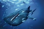
The biggest fish in the world - not blue whale as one might think, because the whale belongs to a ma
Before it was invented fridge, its functions were performed in the ice, which was considered a preci


Предлагаем восстановить, заказать, купить диплом Вуза в любом городе России. Только настоящий бланк ГОЗНАК с гарантией.
All rights reserved